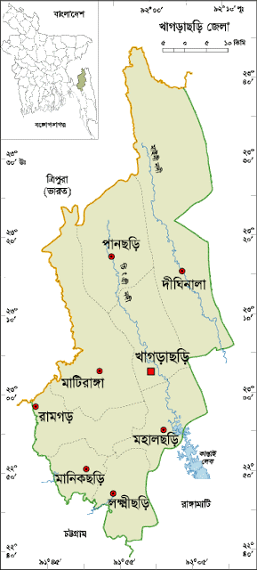
Khagrachhari District
The Chittagong Hill Tracts was a integrated part of greater Chittagong before 1860 AD when the British Government declared as a separate district. The then Chittagong Hill Tracts comprise of 03 (three) Mahakumas. Ramgarh was one of them which also comprise of 03 (three) Thanas namely Ramgarh Sadar, Mahalchari and Dighinala. Khagrachari was a union of Mahalchari Thana. Later in 1968 AD Khagrachari also upgraded to Thana. Then later 1st November 1983 Khagrachari was declared as complete district. Though Ramgarh was an ancient inhabited place but because of the geological position, circumstances condition and communication facilities Government declared Khagrachari as district headquarter. The name Khagrachari originated from the bush of “Nal Khagra”. A canal passes through the Khagrachari Town of which in two banks this Nal Khagra bushes there. Beside this two main river Chengi & Maini passes through Khagrachari which originated within the territory of Bangladesh. The location of this district is Latitude 22.38’ to 23.44’ North and Longitude 91.42’ to 92.11’ East and surrounded by in North-North-West Tripura of India, in East-South-East of Rangamati District, in South-West Chittagong District and in the West Feni River & Part of Tripura of India. A declared land port at Ramgarh not yet started. Some very important fights of 1971 liberation war has happened in this area. Mysterious Alutila Cave is in Alutila Hill near by the town from where a bird eye view of the town can be seen. A very potentials in tourism sectors is here to develop.